Precision Aerial Surveys, Photography, and Cinematography in Utah
Precision Aerial Data Acquisition
For any form of aerial survey required across Utah, including advanced magnetometer and electromagnetic surveys, precision LiDAR mapping, and comprehensive GIS data acquisition, Provo Helicopter Charters delivers extensive operational capabilities. We leverage the unique low-altitude flight and stable hover characteristics of helicopters to achieve superior data resolution. Furthermore, we specialize in high-definition aerial filming and photography services, providing access to cutting-edge cinematography technology or the practical option of door removal for specialized handheld capture. We optimize your aerial data collection and visual media production requirements throughout the Wasatch Front.
Aerial
Surveys
LiDAR, GIS Maps, FLIR, HD Video & More
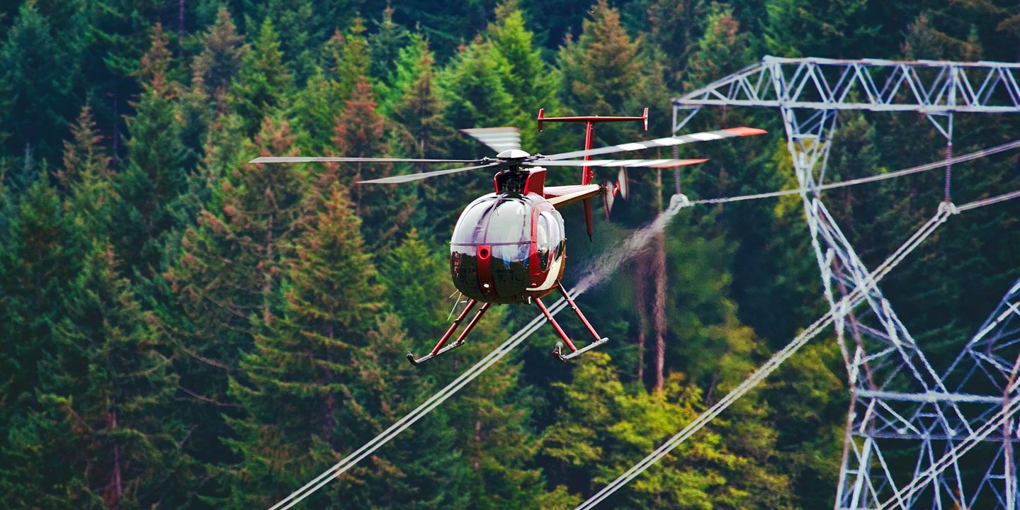
Provo Helicopter Charters facilitates critical infrastructure inspections, from detailed pipeline surveys and Right-of-Way (ROW) assessments to comprehensive transmission line patrols. We provision suitable aircraft, integrate specialized equipment, and coordinate precise aerial operations to ensure your project objectives are met with exceptional accuracy and efficiency.
High Tech Results
The Top Pilots in Utah, Today's Technology... Maximum Results.
Call 1-866-826-4826 Now!
Provo Helicopter Charters provides the tools needed to complete your land surveys, utilizing the right equipment to provide the aerial photos that are often needed.
An effective aerial survey simplifies complex operations such as Right-of-Way and site inspections, the accurate acquisition of topographical data, and the capture of high-definition imagery for commercial projects in Utah. Helicopter surveys offer the optimal method for comprehensive visual assessment of the diverse Utah terrain, enabling precise pipeline leak detection, identification of transmission line anomalies, and detailed photographic or video documentation of commercial properties. Provo Helicopter Charters excels in developing bespoke photographic and remote sensing operations, engineered for maximal technical accuracy, financial efficiency, and verifiable project results.
The inherent capabilities of a helicopter, including its capacity for low-altitude, slow-speed flight, establish it as the definitive platform for aerial surveying. Unlike fixed-wing aircraft, which are generally constrained by FAA regulations to minimum altitudes of 1,000 feet above the highest obstacle, helicopters can operate significantly closer to the terrain. This distinct advantage allows for thorough inspection of challenging or hazardous zones, providing engineers and project managers in Utah with critical perspectives unattainable through conventional aerial or ground-based methods.
There is no better way to conduct your visual survey, animal population counts, soil drainage analysis, ROW inspections, pipeline and transmission line inspections, and geographical surveys.
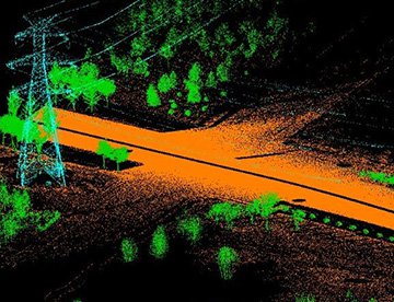
LiDAR Imaging
Light Detection and Ranging, or LiDAR, is a remote sensing method used to examine and measure Utah topography as well as objects, like vegetation, upon it.
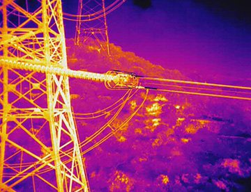
Infrared Imaging
Thermographic IR cameras are used to detect radiation in the long-infrared range of the electromagnetic spectrum and produce images of that radiation, called thermograms.
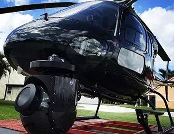
HD Video Gimbal Capture
Modern HD and 4K cameras can be mounted to helicopters, using the proper STCs, with a gimbal to stabilize photos & videos for detailed results.
Advanced Aerial Cinematography and Professional Visual Media
For expert camera work in the Provo Sky
Get a Fast, free QuoteProvo Aerial Cinematography
Provo Helicopter Charters provides comprehensive access to all requisites for professional-grade aerial cinematography across Utah. Our network integrates the latest technological innovations for custom film projects, including state-of-the-art gyro-stabilized camera mounts such as Tyler Mounts, Wesscam, Cineflex, Pictorvision, and SpaceCam. These systems are paired with specialty cameras like Cineflex HD, RED Epic, Arri Alexa, and even advanced 3D or experimental camera arrays. We support all facets of production goals, from precise air-to-air to ground-to-air shots. Our operational teams collaborate extensively with aerial directors of photography and creative directors to ensure the achievement of exacting visual results. Specializing in helicopters for both still and motion photography, Provo Helicopter Charters supports nearly every media-related operation throughout Utah, including feature films, television productions, documentaries, promotional videos, commercials, aerial props, essential relief work for broadcast networks, and comprehensive coverage of historical or major sporting events, deploying a diverse fleet of specialized helicopters.
Call Us Today at 1-866-826-4826 for a Free Quote
Contact Us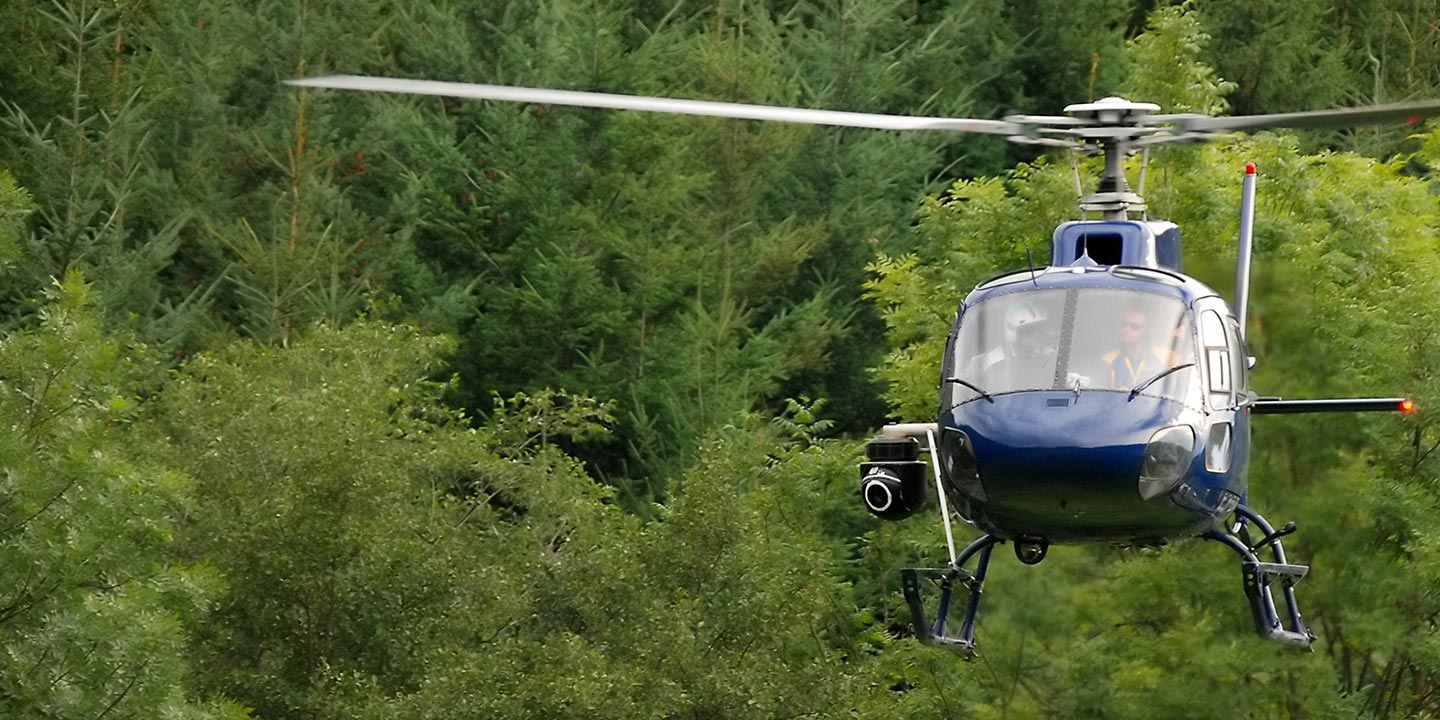
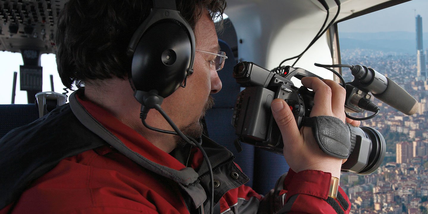
Aerial Photos
Hand-held or Mounted OpTions in Provo
We will help you get the right equipment for your aerial photography project! Call 1-866-826-4826 today to get a fast, free quote.
The Most Options for Photography
Utah's spectacular and dynamic landscapes are optimally captured from an aerial perspective. Embark on a specialized aerial photography charter, meticulously designed to translate your specific artistic or commercial vision into stunning imagery. Provo Helicopter Charters is committed to providing clients with highly cost-effective photographic opportunities across Utah, ensuring exceptional visual outcomes. Many helicopters can be configured with the door removed to facilitate handheld camera operations, and we encourage inquiry regarding advanced gyro-stabilized mounts for superior stability and precision in image capture.
Superior Service
Every one of our customers gets a dedicated helicopter expert to assist with flight plans, tech loadouts, production logistics, project schedules, and other demands.
Over 500 Aircraft
Our network of direct air partners extends well beyond Provo, Utah. This allows us to offer a wide range of solutions for even the most sophisticated projects.
The Best Equipment
From high-tech sensors like LiDAR, FLIR, and GIS to HD cameras and movie production gimbals, we're here to make your job as easy as possible.